
19/50: Arizona


After our time in New Mexico, our first introduction to the beautiful Southwest, we continued to the next state, Arizona. We immediately learned how beautiful the desert can be and how unique its landscape, vegetation, and history are — unlike any other place in the U.S.
Since we were traveling from Santa Fe, we were pretty far north and didn’t have to be in Phoenix for our STATE 19: AZ project for a few days, so we ventured slightly North along the Arizona and Utah border.
It wasn’t an easy trek getting there, though. First, we drove through a foggy, windy blizzard of a storm and arrived late at night at historic Gouldings RV & Campground. I woke up at sunrise and was amazed by the red rock hills surrounding our Airstream and then saw the buttes and their long morning shadows in the distance — it was breathtaking. Then I noticed our trailer, the half-inch thick coat of ice plastered on the windows, and aluminum siding from a rough and wet drive.


Once Kendra and Noel smelled the coffee, we woke up and drove to nearby scenic Monument Valley Tribal Park. The land belongs to the Navajo Nation, which encompasses the largest land area retained by a Native American tribe. Since it’s tribal land that is purposefully preserved, there was a small $20 vehicle fee to drive through their sacred land that has been a part of their history for generations — which was well worth the price of admission.


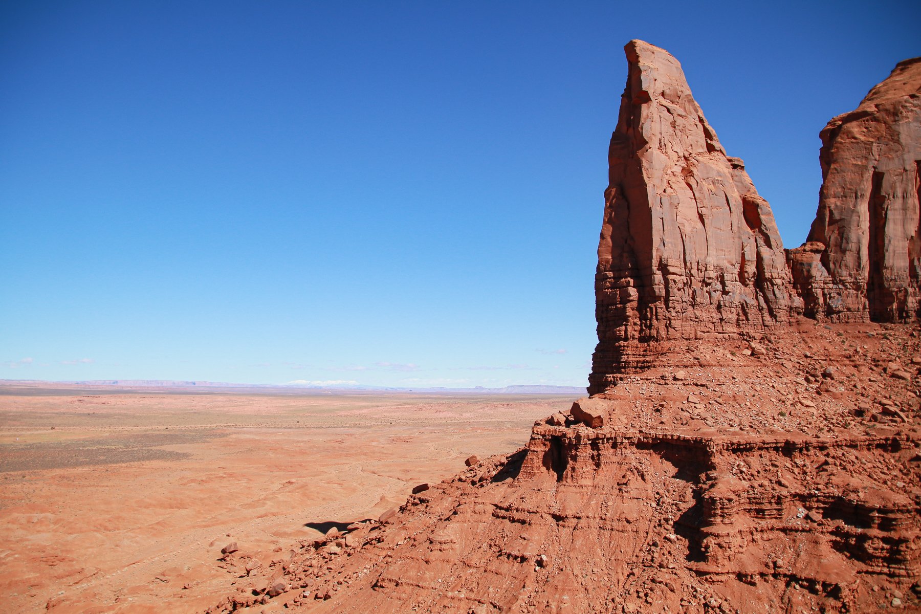


The beginning of the drive features one of the most photographed pieces of land in the country. These wind-blown sand and water-eroded landscapes have been featured in countless movies, photoshoots, and family vacations for decades. Before that, they were spiritual and sacred places for indigenous peoples. And even before that, this land was a lowland basin that, over millions and millions of years, has gradually been eroded by nature, eventually revealing the buttes and mesas we gawk over to this day. And thanks to Navajo Nation, for years and years and years to come.


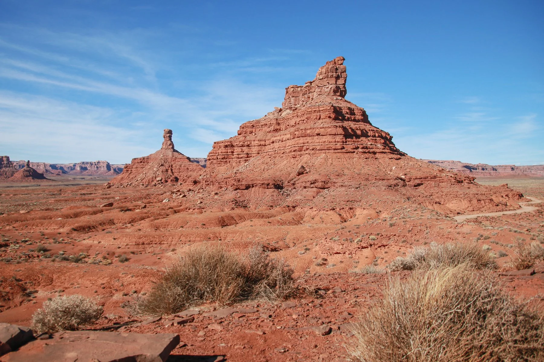
After making the scenic drive for a couple of hours, we continued our adventures to another amazing piece of nature’s wonder: Valley of the Gods — near Mexican Hat, UT. And yes, that’s a real place along the San Juan River with a population of 31 on the northern edge of Navajo Nations land.
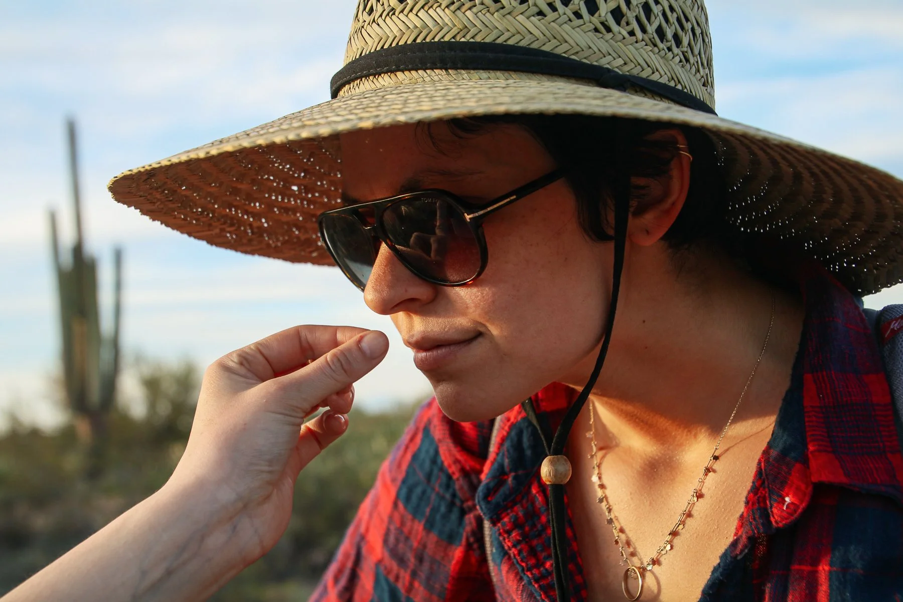
We almost hit a slow-moving tumbleweed. No joke, we have a picture to prove it.


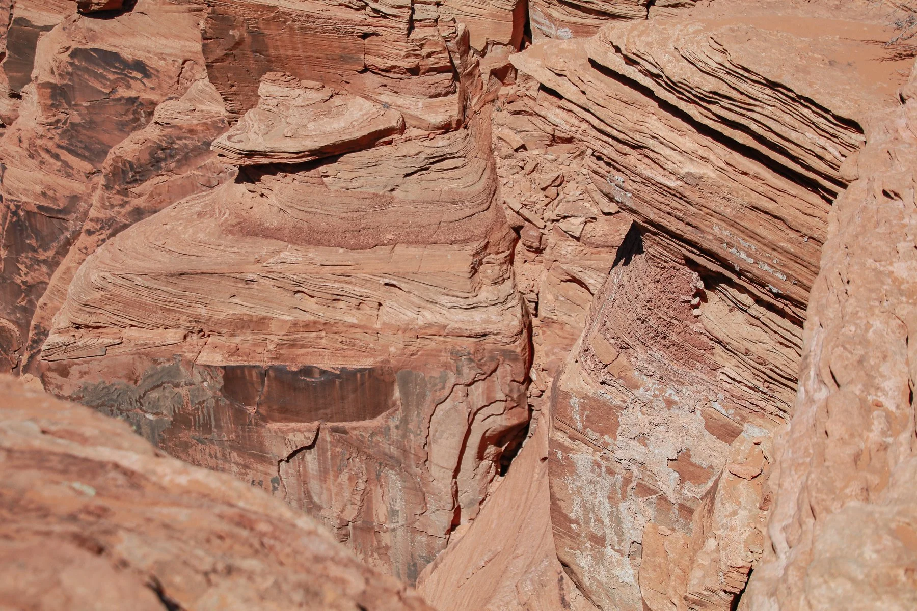
Valley of the Gods is a “smaller” version of Monument Valley that features similar sandstone buttes, mesas, monoliths, pinnacles, and more that have been gradually eroded, shaped, and formed over millions of untouched years. There’s a 17-mile dirt road/path that goes around and through the gorgeous terrain, free for anyone to drive on since it’s public land protected and managed by the U.S. Bureau of Land Management (BLM).
We didn’t know this at the time, but this was once part of Bears Ear National Monument that Obama made a Presidential Proclamation to protect in December 2016, which was “the first national monument created at the request of and with input from Native American governments” according to a Washington Post article. However, nearly a year later, Trump reduced the size of this protected land by 85%, which thus excluded Valley of the Gods, leaving it to go back under the management of the BLM.
Without fully understanding the politics involved and the future of this area, all we can say and share is how beautiful it is and how much it needs to be protected and left as untouched by human hands as possible. It was one of my favorite experiences on this 50 States journey.


On our drive back towards Monument Valley and our campsite at Goulding’s, we couldn’t help but reenact the famous running scene from one of my favorite childhood movies, Forrest Gump.

Once we got back to the RV park, we packed up our belongings and headed back down to Arizona, where our journey was just getting started. But first, we needed a heavy power wash job to get the remaining ice, dirt, and debris from the truck and trailer. We love the Four Corners area's red sandstone color, but not on all our stuff.


We had two main route options to get to our next destination: drive directly to Phoenix, or take a half-day detour so we could go through Petrified Forest National Park. Of course, we opted for the scenic route. Come to find out; it was once part of the historic Route 66 from Chicago to LA.
We could hardly imagine the number of family station wagons that have once driven this route, which has undoubtedly shaped the notion of what a great "American road trip” looks and feels like. This was that.


A drive through the 28 miles of roads and scenic turnouts was an unworldly blast from the ancient past. The grounds were once lush forests inhabited by early dinosaurs and prehistoric plants over 225 million years ago. Now, it’s home to fossils of all kinds, the Painted Desert badlands, and the Petrified Forest, which features ruins of forests whose trees have been fossilized into stone.


The long shadows and the approaching sunset were our cues to continue driving toward Phoenix, where we stayed overnight in yet another Walmart parking lot. The following day we were excited to pick up a couple of hitchhikers.
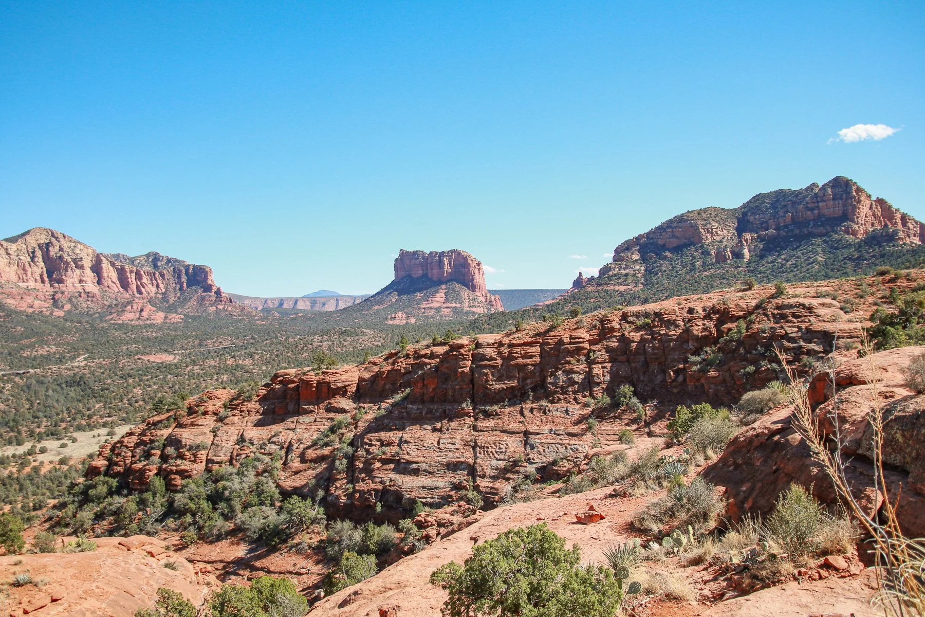
Our good friends from Grand Rapids, MI, Seth, and Sally, flew out to Phoenix to visit us and another of their friends. We scooped them up from an AirBnB house rental near Phoenix and drove a two-hour drive north to Sedona. We’ve all heard of Sedona before, but none of us knew what it was or how amazing it would be. If you want a Live look for yourself, visit EarthCam to see live camera feeds.
Let’s say when I realized we were only staying one night instead of two as I expected; I was genuinely disappointed. So, we filled our time there as best as possible, starting with a handful of scenic views of beautiful Red Rock Country.


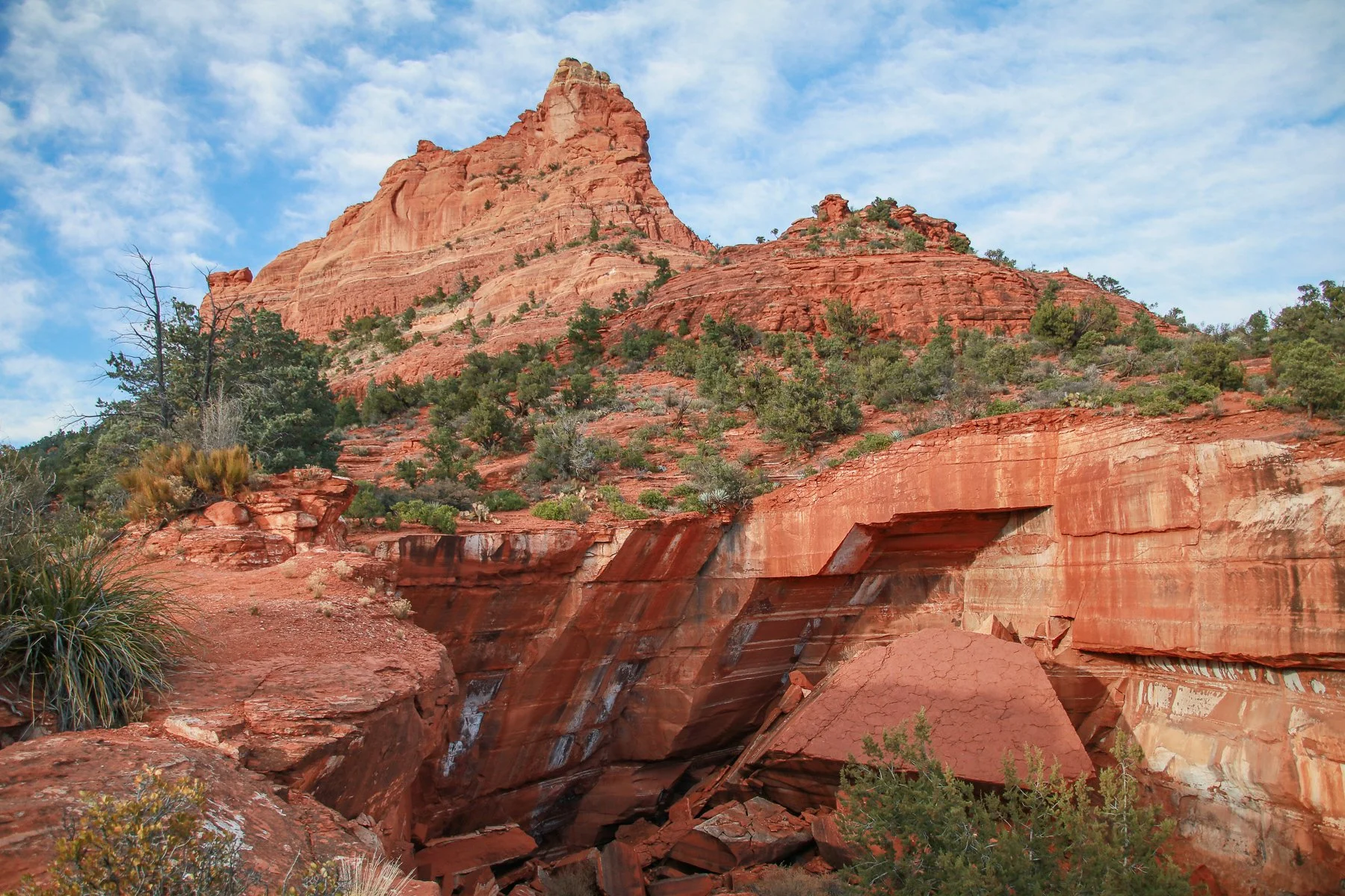


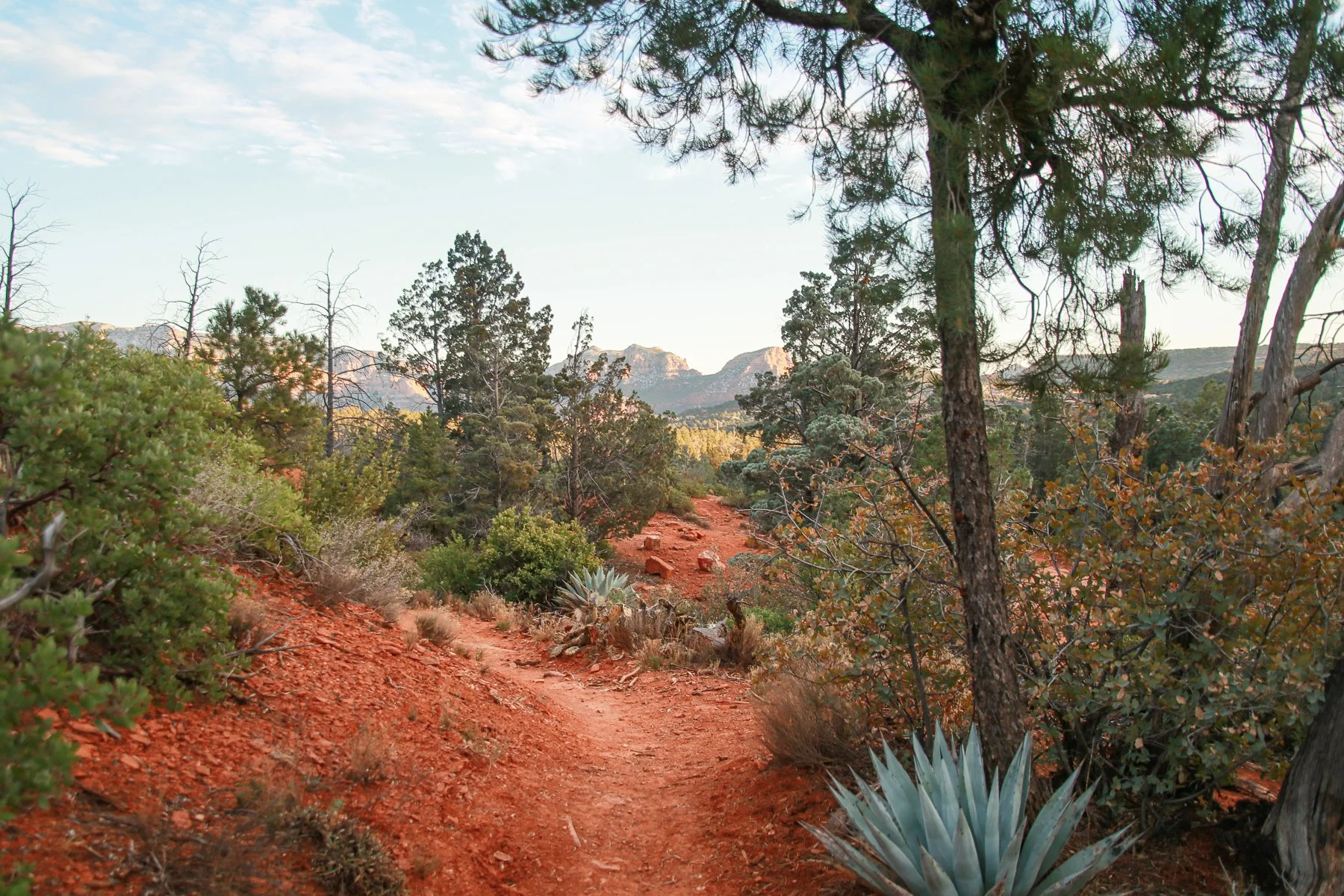


Our first hike was on Soldiers Pass Trail, where in addition to the views of the, we encountered the Devil’s Kitchen Sinkhole. The large hole cave-in back in the early 1880s, with another piece falling in 1989, enlarging the gaping hole in the ground by nearly one-third.
As our shadows got longer, we returned to the truck. Of course, I was lagging behind a few paces to stop and take pictures, so Kendra thought it’d be funny to pretend that we were locked in and had to stay the night. But, unfortunately, there were automatic dates into the parking lot that closed at 6 pm. It didn’t take more than a half-second to call their bluff, but they still tried to act like it was locked — even going as far as to bother a local neighbor and ask. (Eyeroll).
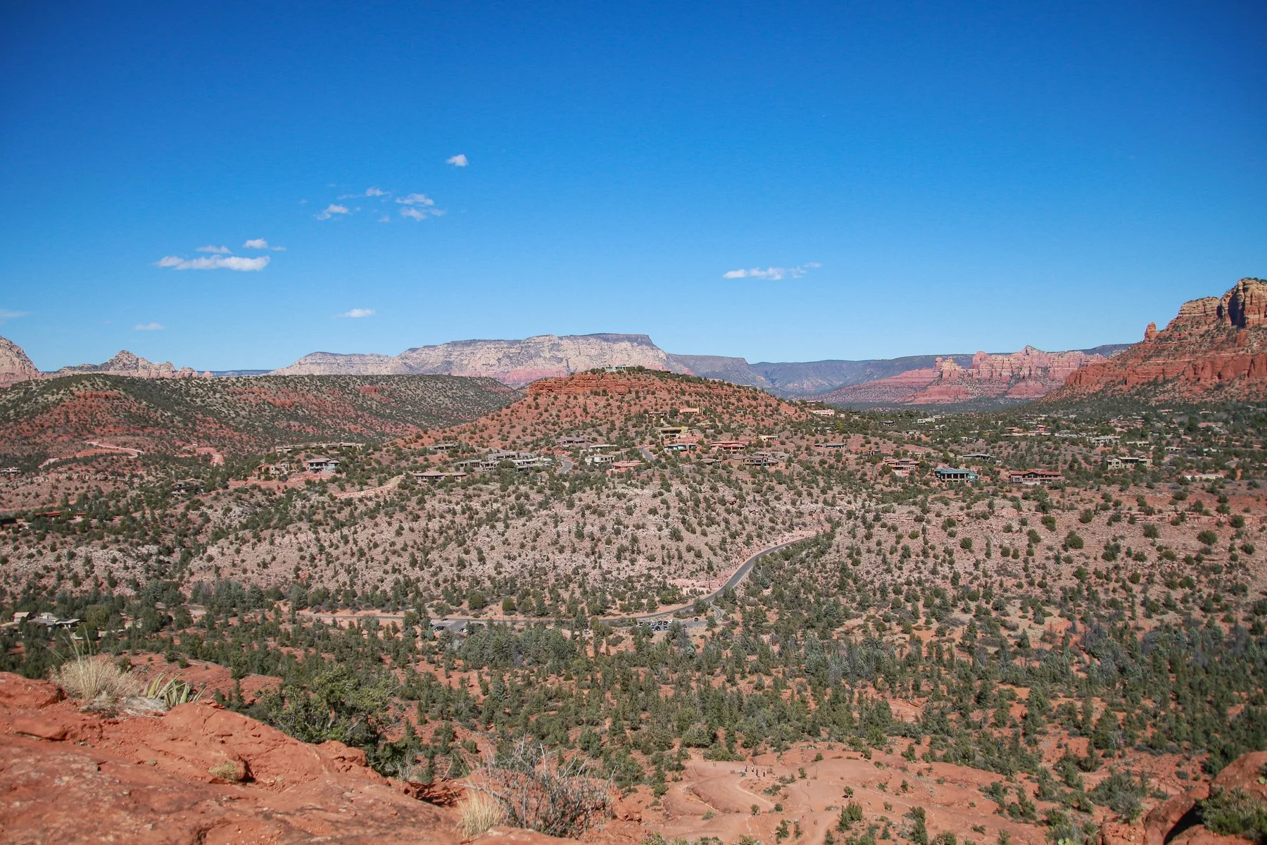
Once they caved in, we hopped in the truck and headed to Airport Mesa for the best sunset views of Sedona. We looked for cheap food options but discovered that most Sedona is fine dining. Luckily, we found a little hole-in-the-wall Mexican joint that satisfied our cravings before returning to our Airstream for homemade cocktails and Sequence board game.


The next morning, we woke up to another beautiful day of sunshine and hiking. This time, we ventured to Cathedral Rock Trail on a hike that was much harder than we imagined for a 1.2-mile long trail. It was straight up with nearly an 800-foot elevation gain, with some of its more difficult sections more like rock climbing than a hiking trail. I’m pretty sure it’d be impossible to climb on a wet, rainy day.


Once we made it up to the trail's end, the views were worth it. Totally worth it.
Our last stop in our short visit to Sedona was the Chapel of the Holy Cross, a Roman Catholic chapel built into the red rock buttes with a story behind it. Marguerite Brunswig Staude, an heiress and an artist who lived and worked in New York and Los Angeles, dreamed of building a chapel shaped like a cross after seeing the Empire State Building in 1932. She originally wanted to make it in Los Angeles but couldn’t get the required approval, then in Budapest, Hungary (with the help of Lloyd Wright, son of one of my favorite architects Frank Lloyd Wright) — but the breakout of WWII halted their ability to do so.
Years later, she married and moved to Sedona, where she spotted the location while flying into town sometime in the 1950s. She hired a San Francisco-based architecture firm to design and build the chapel that was completed in 1956 in honor of her late parents.
Marguerite donated the chapel to the Roman Catholic Church but requested that no services be held there. Instead, she wanted the chapel to be a place to pray, reflect and find God through the beauty of art — which we most certainly did.


After we made it back to Phoenix, completed our STATE 19: AZ project at Magnetry, Inc., and got a haircut from Seth (look at that beard length!), we took ourselves out to the ballgame to see the Cleveland Indians play the Texas Rangers for a spring training match at Goodyear Ballpark.


The sad part was Seth and Sally thought their flight was the next day at 12:30 PM. Instead, they found out while we were sitting in the grassy outfield that their flight was that night at 12:30 AM. Thankfully, they caught it in time and could still catch their flight.
Unfortunately for us, however, they left.
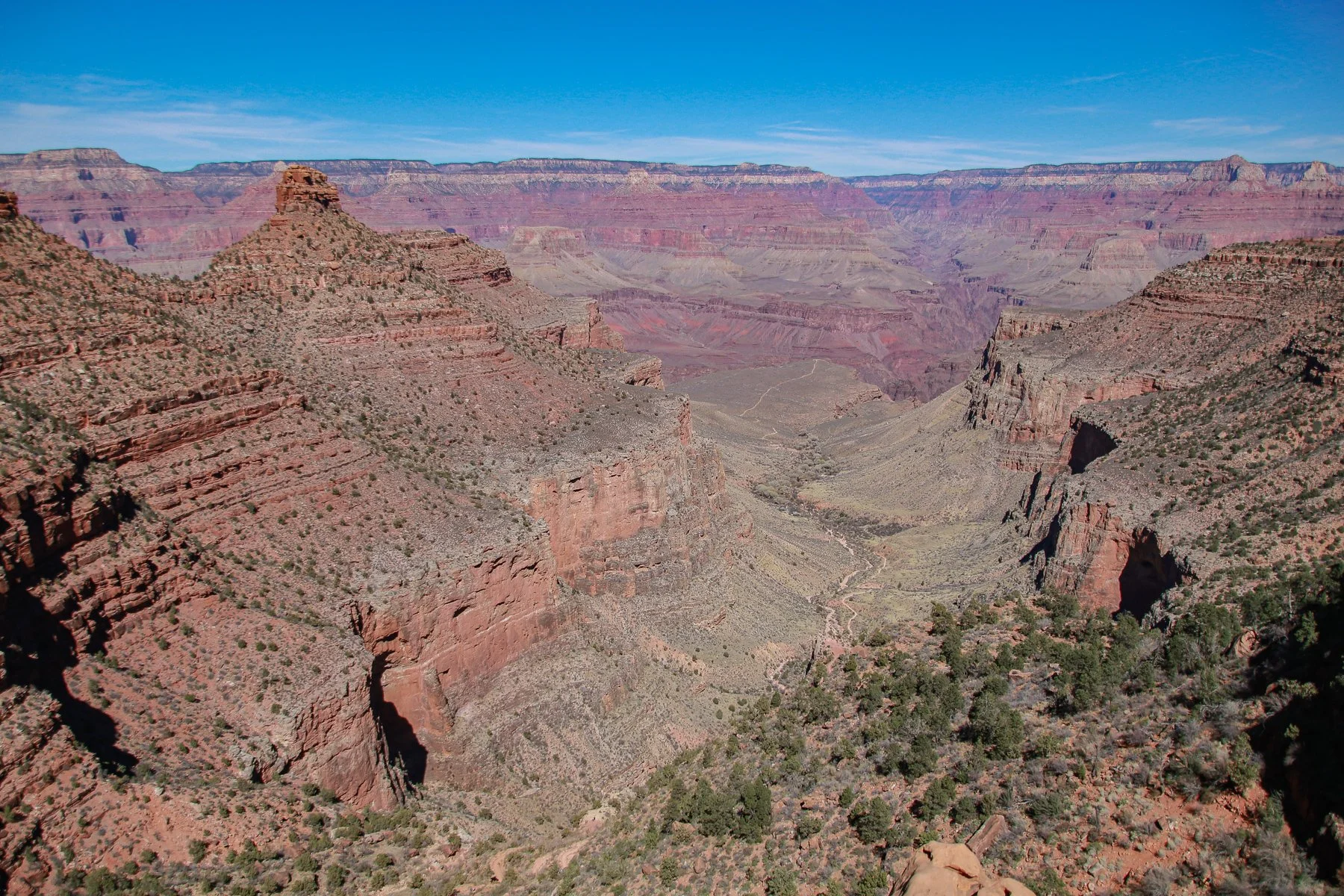
Thankfully, we had a visit to the Grand Canyon to take our minds off missing them. Arizona is self-proclaimed as “The Grand Canyon State,” after all, so we had to visit. It was my first time here, and I’d say GRAND is an understatement. It is enormous, hard to comprehend, scary to look down, yet hard to take your eyes off. We spent most of our first day walking, driving, and exploring the south rim.

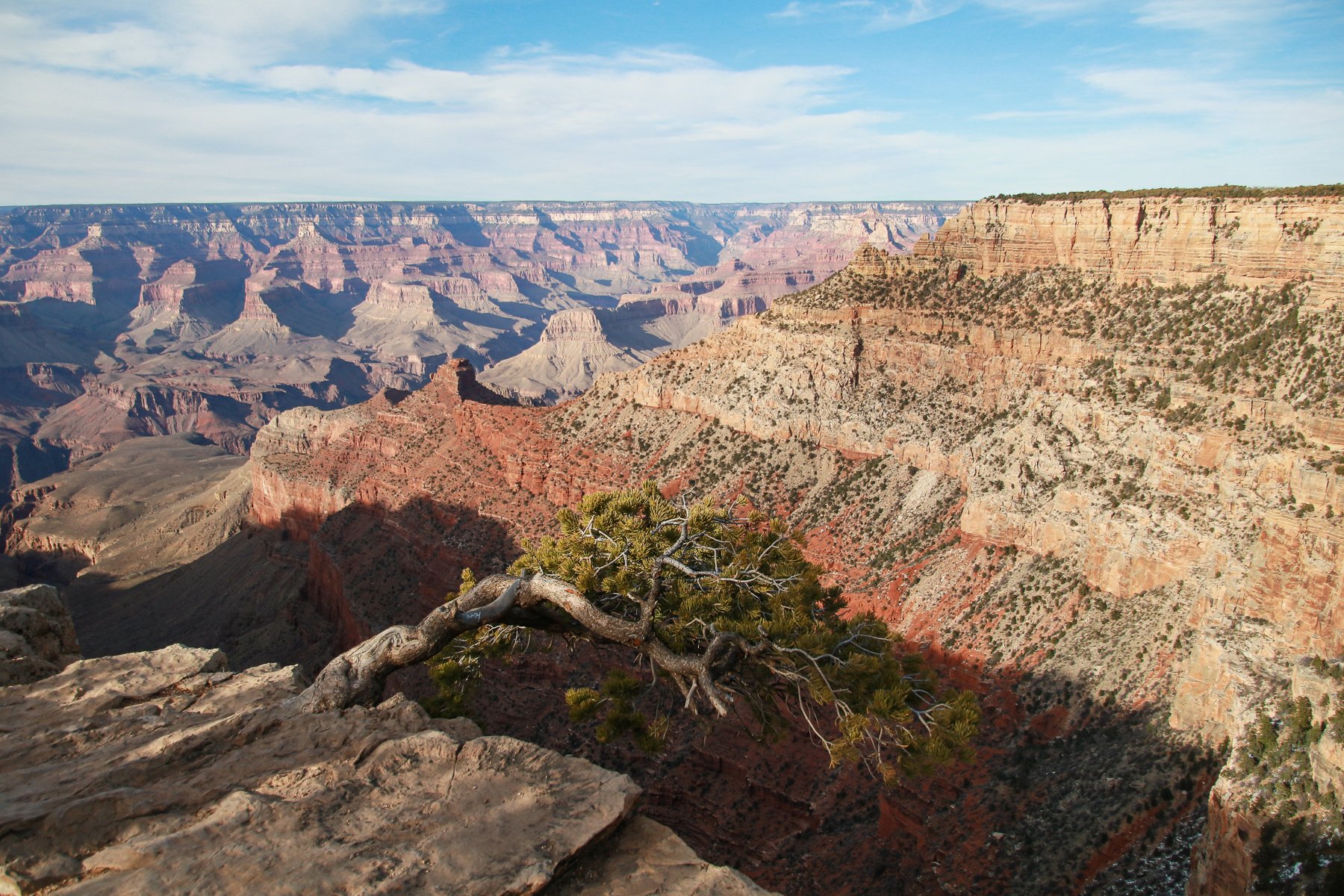


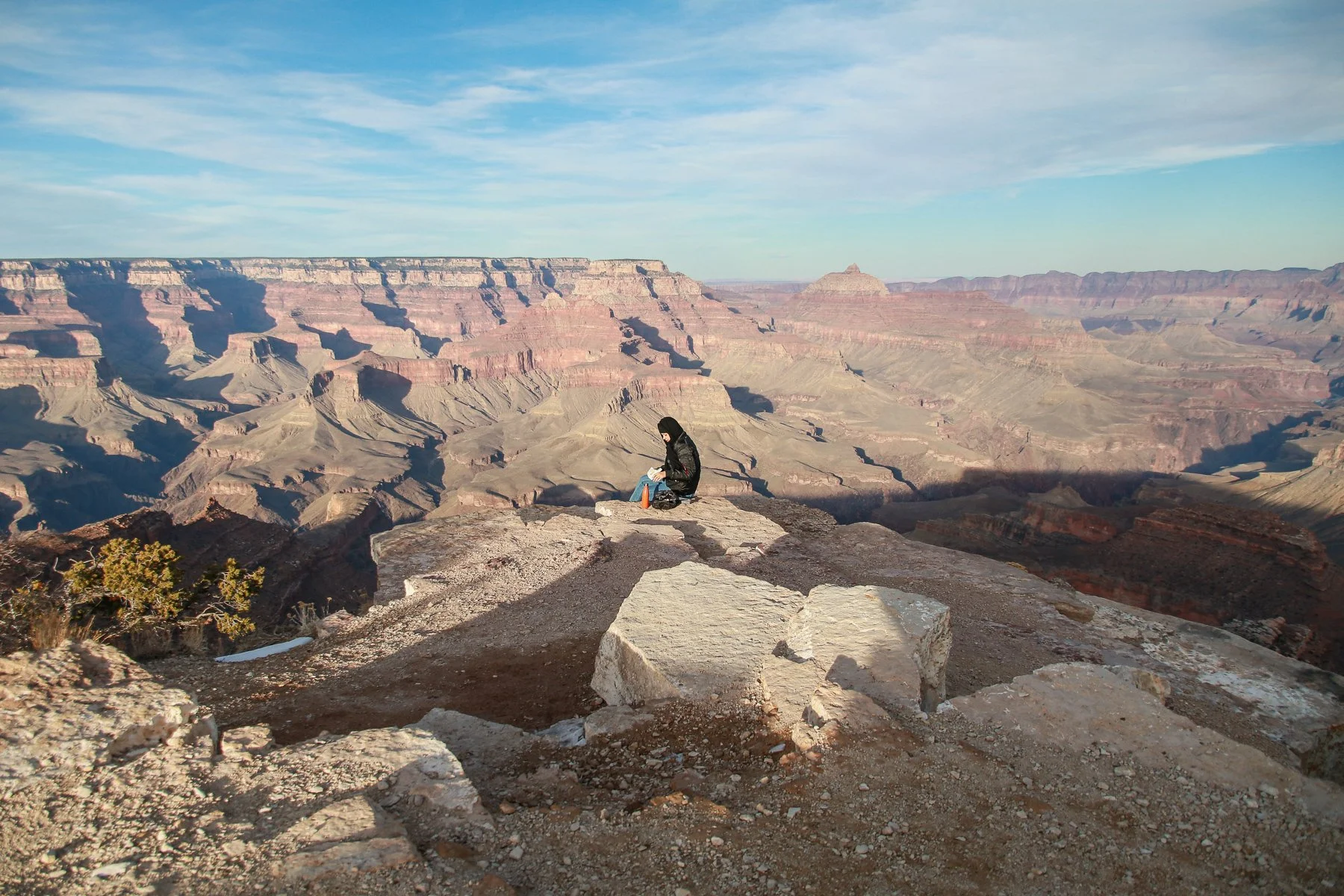


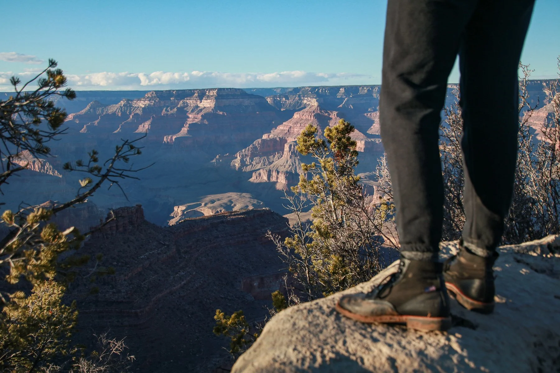


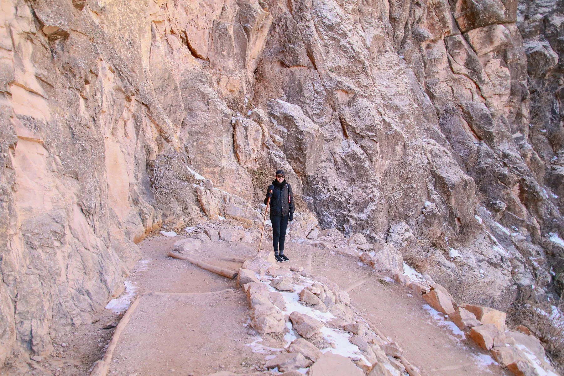
The following day, we wanted to conquer the Bright Angel Trail into the canyon. Little did we realize that even though it was early March, there was still snow along the trail, especially in the shaded areas. Worse yet, the more tourists and hikers walked on it, the more packed down and hardened it became. Oh, and there was plenty of mule poop to dodge. It also didn’t help that we weren’t the most prepared with the proper footwear or ice cleats.
The trail is 17 miles long, down and back, with a 5,000-foot elevation change. We made it as far as the 3 Mile Rest House. We had lunch, met a friendly park squirrel that would steal any food he could get his paws on, enjoyed the views, and made the safe decision to hike back up rather than push ourselves much further.
Not to say it was an easy hike up. We were gassed and happy to be on flat land again.
NOTE TO SELF: Be better prepared next time and set realistic expectations.


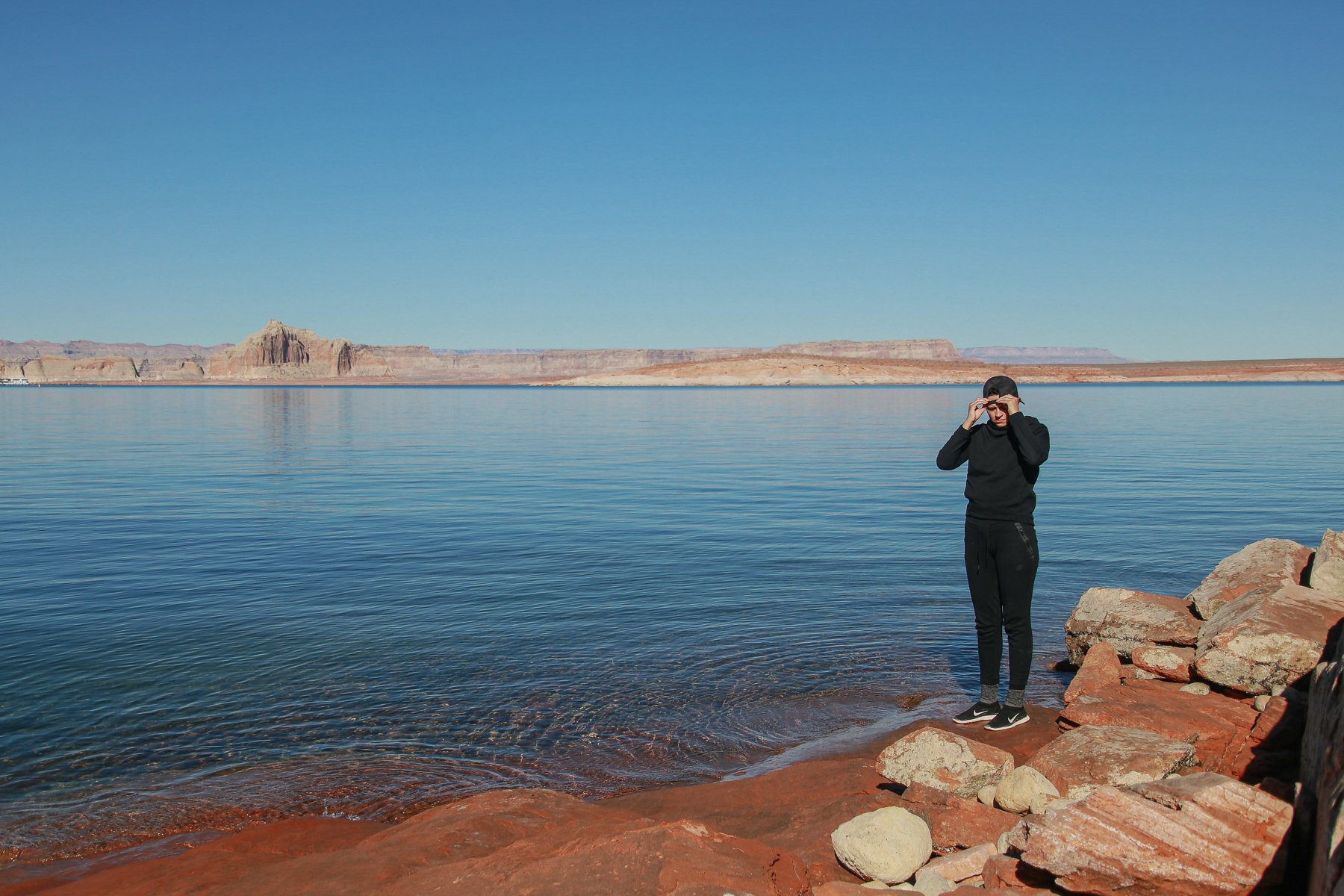
The next day we woke up still a little sore, yet we managed to drive a couple of hours northeast to see one of the most photographed sections of the Colorado River at Horseshoe Bend. A 1,000-foot drop makes just about anyone’s knees a little wobbly. It took Kendra a few moments to work up the courage to (safely) peer over the edge.


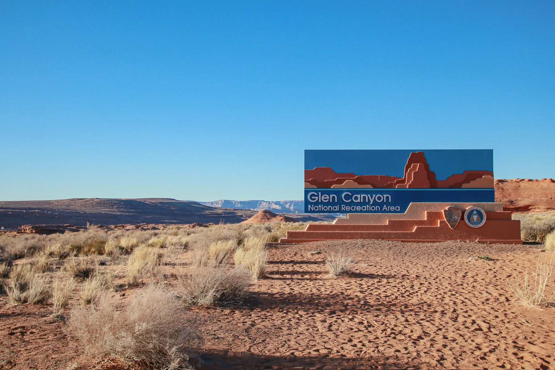
If we had the budget and could plan ahead, we would have loved to visit Antelope Canyon. But since it’s on Navajo land and requires reservations booked in advance, it wasn’t possible for us this time around. So instead, we visited Glen Canyon, which is home to the Glen Canyon Dam that holds back Lake Powell, allowing a controlled amount of water to flow through its hydroelectric turbines that travel down through the Grand Canyon and beyond.
The dam was completed in 1966, which gradually filled and formed Lake Powell, reaching capacity for the first time in 1980. However, in these recent years of drought, Lake Powell levels receded considerably, reaching the lowest it's been in decades, prompting friends and filmmakers to explore slots that haven’t been seen in generations. Check out their short film on National Geographic.
We weren’t entirely equipped to do such a 42-day excursion. Still, we did hike down to the water, throw some sandstone rocks into pieces, and even laid down on the sun-warmed cliffs that were once large buttes, mesas, and other formations before being flooded over and drowned to make one of the largest man-made reservoirs in the country.


On our drive back to our Airstream, we could see the beginning of the Grand Canyon in the distance. It was mind-blowing to think they were in space as the Colorado River was out of sight in what looked like a crack in the earth that you could jump across… Then, to think that the crack will soon expand into the Grand Canyon? CRAZY.


We packed up and checked out of our Grand Canyon Village campsite and drove five hours south back through Phoenix to Tucson, where we pulled into a Cracker Barrel parking lot to stay the night.
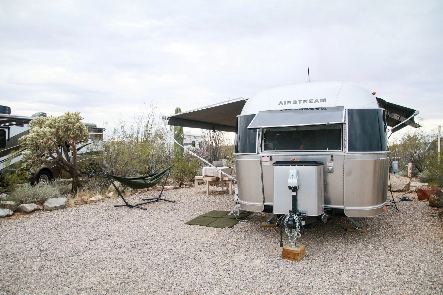
Early the following day — and I mean EARLY, we rushed to Gilbert Ray Campground because it’s a first-come, first-serve campground in the heart of the Tucson Mountains and just a few miles from Saguaro National Park. So not only is it in a prime location in the middle of nature, but it’s also only $20 per night — but be wary because it’s cash or checks only in a self-pay fee station, none of those plastic credit card things.
To make things even better, Kendra’s sister visited us! She flew down from Michigan for the week and timed her to stay with her friend that lives in Tucson so that it would overlap with our schedule. She joined us for meals at the campground and hikes around us.


While Kendra and her sister were visiting the Desert Museum, Noel and I had a few hours to catch up at work at one of the best “offices” we’ve had on the tour yet. Wifi didn’t exist, but it was a great time to edit photos. Noel, however, didn’t really do much other than a nap in my notebook and occasionally peek out the screen door to check on me.
Kendra and Veronica did make it back in time for a delicious home-cooked meal and sunset views from the trailer. There’s nothing much better than that…


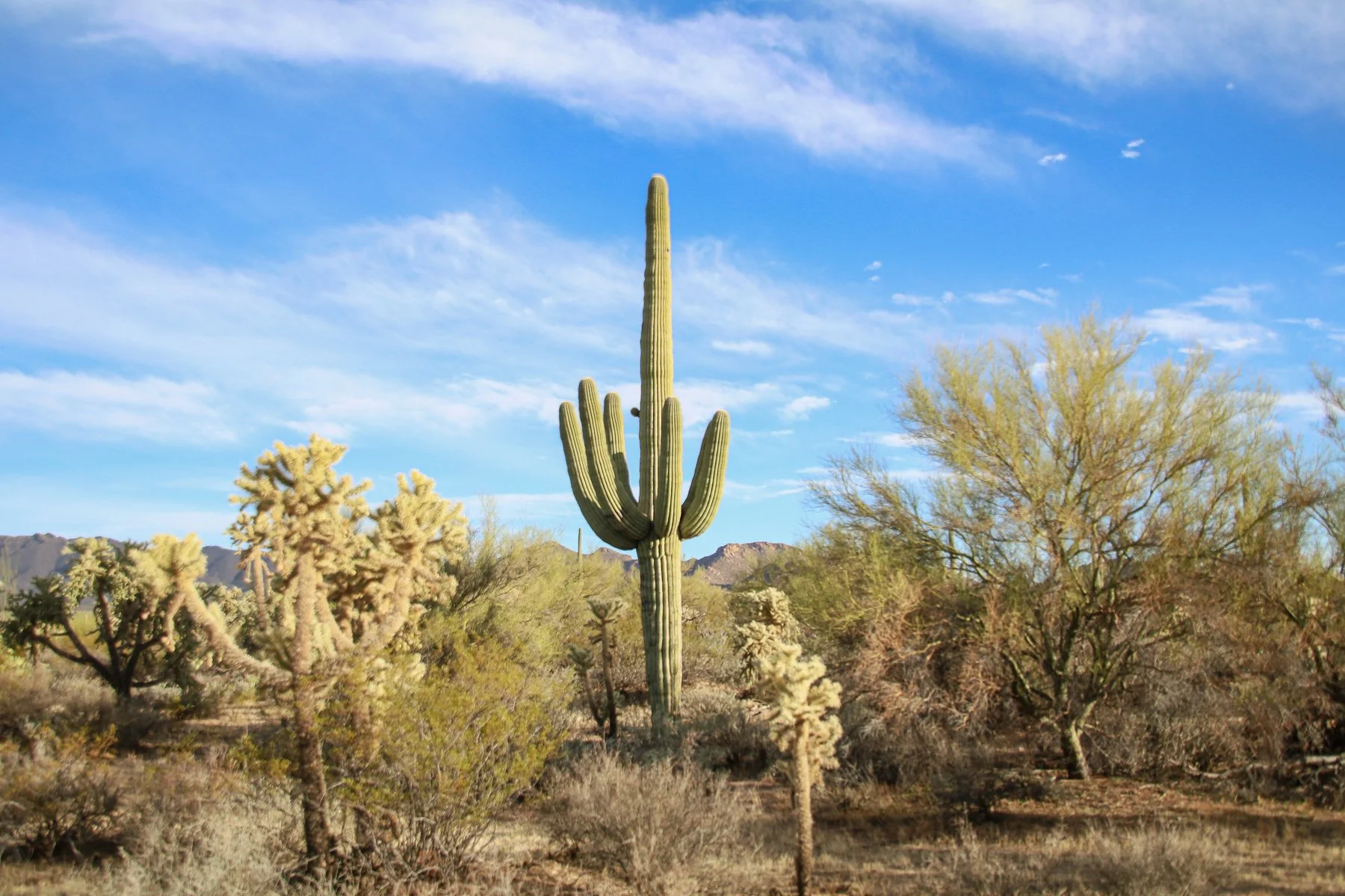
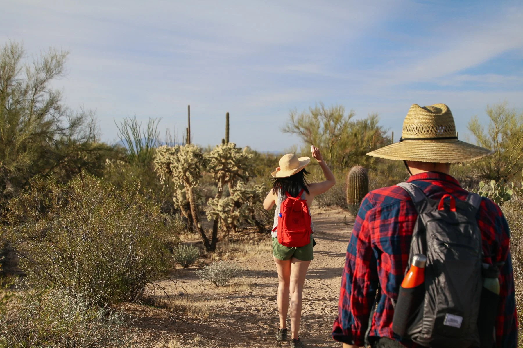
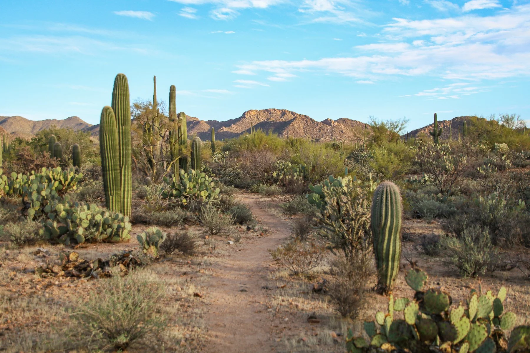
The next day we hiked Saguaro National Park, where we experienced first-hand just how large a saguaro cactus can grow: 40-50 feet tall. They only grow in the Sonoran Desert, but they don’t even grow in all parts of it, hence why a National Park is protecting these 100-200-year-old tree-like cacti.
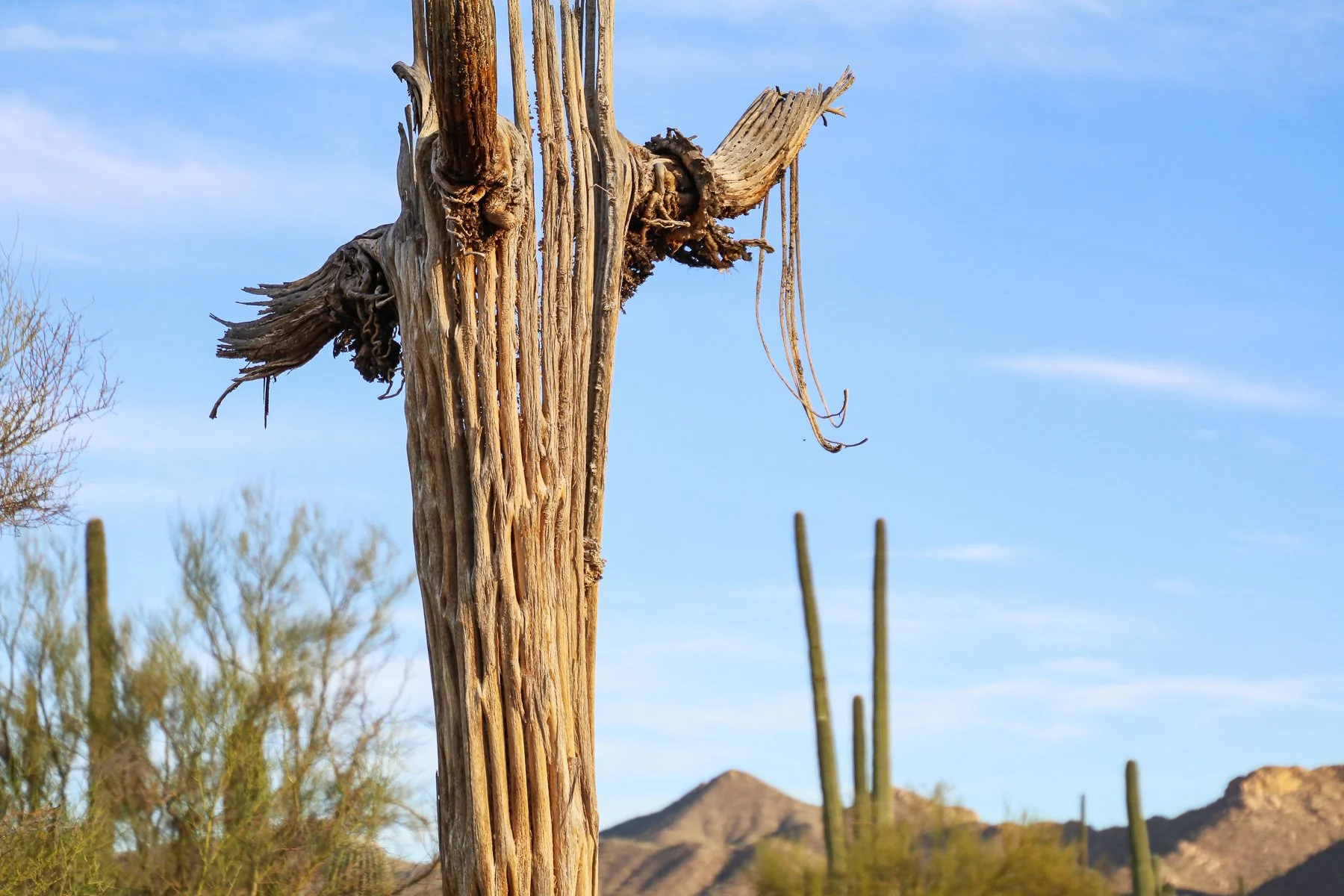
They’re so tree-like that their spine dries and hardens when they die into a wood-like material. And as Kendra’s sister found out, the spikes can draw blood relatively quickly with barely a prick of your finger.
Another fantastic fact about the saguaro cactus is that it’s a very slow-growing plant. It may take ten years for a seed to grow nearly two INCHES tall. Then it’ll take another 75-100 years to develop its arms if it grows any.
The saguaro blossom is the state flower, but it typically only blooms at dusk and will wither and die by the following day. However, a single saguaro can produce up to 100 flowers during its May-June peak season. In addition, the saguaro is so protected in Arizona that it’s illegal to cut one down, even if it’s dead and in your backyard.
On top of all that, they’re beautiful and weird to admire all at the same time.


Another cactus that is infamous in the Sonoran Desert is the organ pipe cactus. We were on our way to Organ Pipe Cactus National Monument when Noel got car sick for the first time on the tour. The road from Tucson to Why (yes, that’s the name of the closest town in Organ Pipe) was up-and-down wavy, which Noel did not agree with.
We had to turn off the two-lane road and make sure she was OK and clean out the back of the truck. It was a mess.
Considering the struggle and knowing we’d be spending the next few days without water or electric hookups along the Mexican border in the Sonoran Desert, we decided to change plans. Instead of roughing it in the desert, we opted for AC and Wifi at Leaf Verde RV Resort in Buckeye, AZ.
They had one spot left.
Arizona is well-known for its retirement communities, which we’ve learned also include RV parks — many of which are 55+ years of age, which we would barely qualify for if we added our ages together. The parks that aren’t 55-and-up are few and far between, and there’s a lot of demand for them. So if you plan to visit Arizona in peak season, plan ahead with reservations or pray that you’ll get lucky. We got lucky. This time.
